
Description
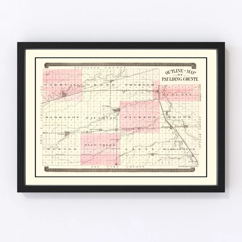
Discover a piece of history with our beautifully restored 1892 vintage map of Paulding County, Ohio. Perfect for those who cherish local heritage and want to bring a touch of the past into their space, this map highlights notable towns such as Paulding, Antwerp, and Payne. Whether gracing your home or office walls, it adds a classic charm that invites intrigue and conversation.
This print is ready to hang right out of the box. Our dedication to quality shows in each handcrafted detail—from frames made with solid wood that feature a rich stain finish to canvas prints made by hand using polycotton on sturdy wooden stretcher bars. If you prefer an unframed option, you’ll appreciate the high-quality matte paper we use.
Whether you’re gifting it to someone passionate about local history or adorning your own space with its timeless appeal, this 1892 map is more than decor—it’s an homage to Paulding County’s past that’s sure to become a favorite talking point.

Reviews
There are no reviews yet.