
Description
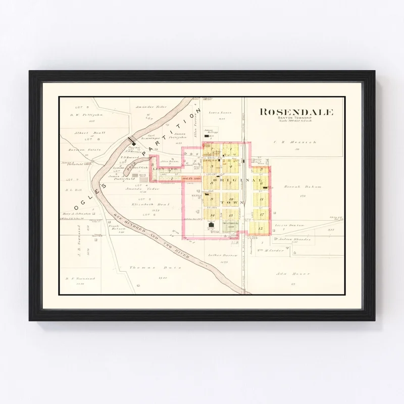
Discover a piece of history with our beautifully restored 1909 map of Rosendale, located in Andrew County, Missouri. This charming vintage map is more than just a glimpse into the past; it’s perfect for anyone who loves local history or classic decor. Handcrafted with care, each print comes ready to hang right out of the box.
Choose from framed prints made from solid stained wood, canvas prints hand-stretched over polycotton material on sturdy wooden stretcher bars, or high-quality unframed prints on matte paper. Whether you’re decorating your home or office, this timeless map adds a touch of class without trying too hard.
This piece isn’t just about aesthetics; it’s also an engaging conversation starter that celebrates the unique heritage and character of Rosendale. Ideal for gifting history buffs or enriching your own collection, our vintage maps invite you to bring a bit of Missouri’s past into your present-day life.
Reviews
There are no reviews yet.