
Description
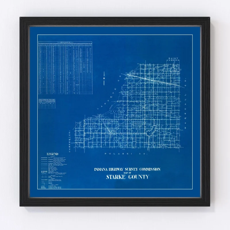
Discover a piece of history with our beautifully restored 1936 map of Starke County, Indiana. This vintage map is more than just an art piece; it’s a glimpse into the past. The county encompasses towns such as Knox, North Judson, and Hamlet, each steeped in local tradition and charm. Perfect for anyone who appreciates the allure of bygone times or has a soft spot for Indiana’s history.
This map fits seamlessly into both home and office settings, offering a tasteful nod to the past. Our prints boast premium quality materials: whether you choose the ready-to-hang framed version with solid wood frames or opt for an unframed print on high-quality matte paper. For those who prefer canvas, you’ll enjoy polycotton material stretched over sturdy wooden bars handcrafted to last.
Not only is this vintage map a stylish addition to any room, but it also makes for an intriguing conversation starter—just right for history buffs or anyone with ties to Starke County.

Reviews
There are no reviews yet.